 English


Yerevan
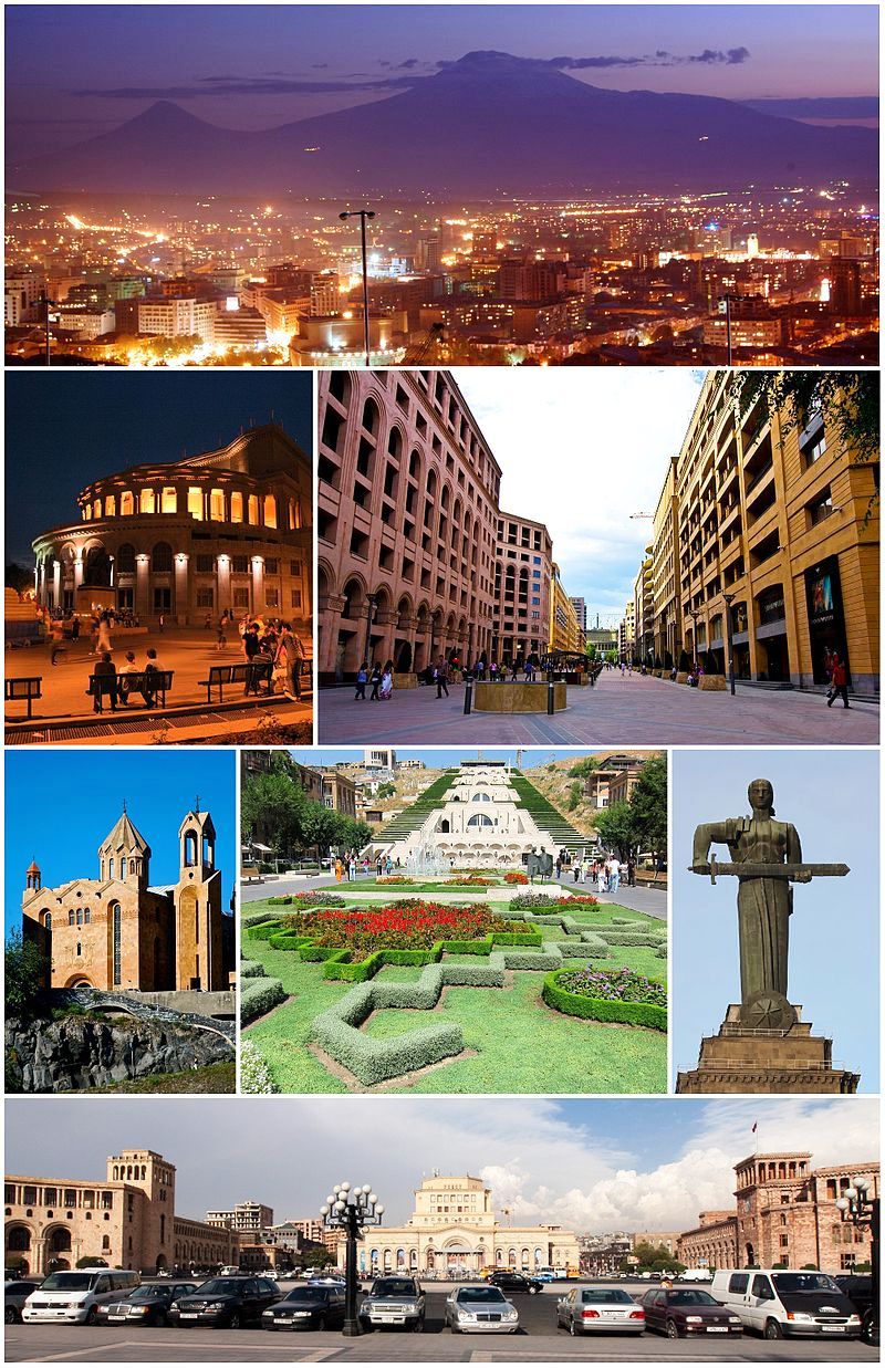
Yerevan (/ˌjɛrəˈvɑːn/; Armenian: Երևան [jɛɾɛˈvɑn], ![]() listen (help·info)), is the capital and largest city of Armenia, and one of the world’s oldest continuously inhabited cities. Situated along the Hrazdan River, Yerevan is the administrative, cultural, and industrial center of the country. It has been the capital since 1918, the thirteenth in the history of Armenia, and the seventh located in or around the Ararat plain.
listen (help·info)), is the capital and largest city of Armenia, and one of the world’s oldest continuously inhabited cities. Situated along the Hrazdan River, Yerevan is the administrative, cultural, and industrial center of the country. It has been the capital since 1918, the thirteenth in the history of Armenia, and the seventh located in or around the Ararat plain.
The history of Yerevan dates back to the 8th century BC, with the founding of the fortress of Erebuni in 782 BC by king Argishti Iat the western extreme of the Ararat plain. Erebuni was “designed as a great administrative and religious centre, a fully royal capital.” During the centuries long Iranian rule over Eastern Armenia that lasted from the early 16th century up to 1828, it was the center of Iran’s Erivan khanate administrative division from 1736. In 1828, it became part of Imperial Russia alongside the rest of Eastern Armenia who conquered it from Iran through the Russo-Persian War (1826-1828). After World War I, Yerevan became the capital of the First Republic of Armenia as thousands of survivors of the Armenian Genocide in the Ottoman Empiresettled in the area.[12] The city expanded rapidly during the 20th century as Armenia became part of the Soviet Union. In a few decades, Yerevan was transformed from a provincial town within the Russian Empire, to Armenia’s principal cultural, artistic, and industrial center, as well as becoming the seat of national government.
With the growth of the economy of the country, Yerevan has been undergoing major transformation as many parts of the city have been the recipient of new construction since the early 2000s, and retail outlets as much as restaurants, shops, and street cafes, which were rare during Soviet times, have multiplied.
As of 2011, the population of Yerevan was 1,060,138, making up to 35.1% of the total population of Armenia.
Yerevan was named the 2012 World Book Capital by UNESCO. Yerevan is an associate member of Eurocities.
Etymology and symbols
One theory regarding the origin of Yerevan’s name is the city was named after the Armenian king, Yervand IV (the Last), the last leader of the Orontid Dynasty, and founder of the city of Yervandashat. However, it is likely that the city’s name is derived from the Urartian military fortress of Erebuni (Էրեբունի), which was founded on the territory of modern-day Yerevan in 782 BC by Argishti I. As elements of the Urartian language blended with that of the Armenian one, the name eventually evolved into Yerevan (Erebuni = Erevani = Erevan = Yerevan). Scholar Margarit Israelyan notes these changes when comparing inscriptions found on two cuneiform tablets at Erebuni:
Early Christian Armenian chroniclers attributed the origin of the name, “Yerevan,” to a derivation from an expression exclaimed by Noah, in Armenian. While looking in the direction of Yerevan, after the ark had landed on Mount Ararat and the flood waters had receded, Noah is believed to have exclaimed, “Yerevats!” (“it appeared!”).
In written sources, Yerevan was also mentioned as Erevan, Erivan, Erewan, Ervan, Eruan,Arevan, Iravan, Revan and Ayravan.
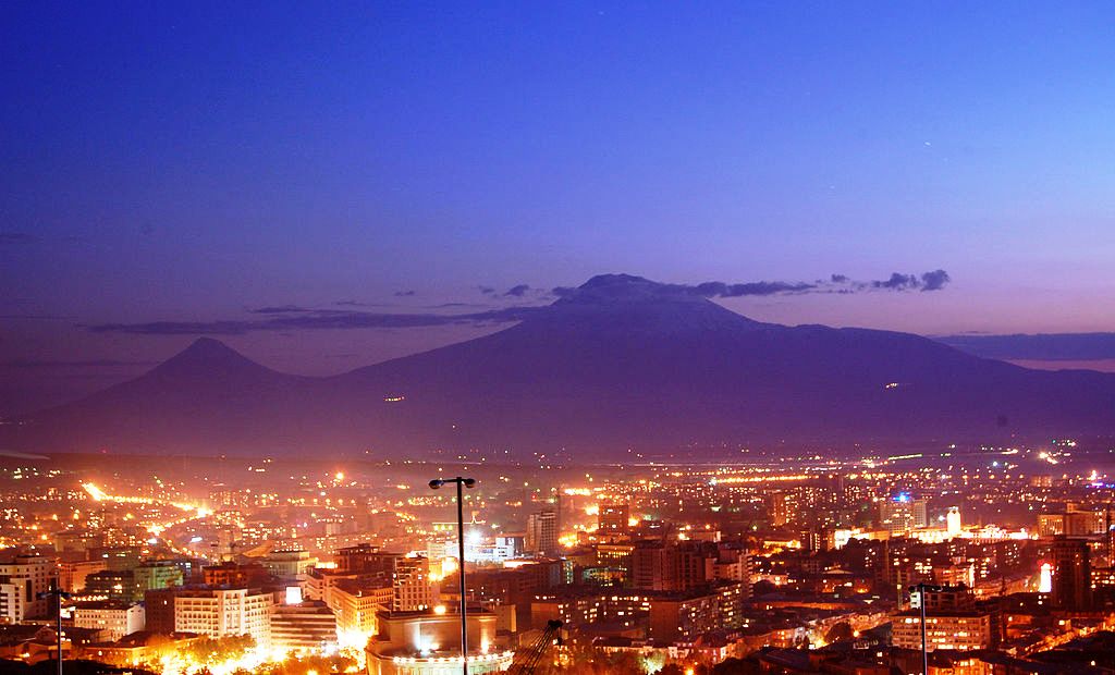
The principal symbol of Yerevan is Mount Ararat, which is visible from any area in the capital. The seal of the city is a crowned lion on a pedestal with the inscription “Yerevan.” The lion’s head is turned backwards while it holds a scepter using the right front leg, the attribute of power and royalty. The symbol of eternity is on the breast of the lion with a picture of Ararat in the upper part. The emblem is a rectangular shield with a blue border.
On 27 September 2004, Yerevan adopted an anthem, “Erebuni-Yerevan”, written by Paruyr Sevak and composed by Edgar Hovhanisyan. It was selected in a competition for a new anthem and new flag that would best represent the city. The chosen flag has a white background with the city’s seal in the middle, surrounded by twelve small red triangles that symbolize the twelve historic capitals of Armenia. The flag includes the three colours of the Armenian National flag. The lion is portrayed on the orange background with blue edging.
History
Erebuni and Urartu period

Erebuni Fortress built by King Argishti I in 782 BC
The ancient kingdom of Urartu was formed in the 9th century BC in the basin of Lake Van of the Armenian Highland, including the territory of modern-day Yerevan. King Arame was the founder of the kingdom, that was one of the most developed states of its age. Archaeological evidence, such as a cuneiform inscription, indicates that the Urartian military fortress of Erebuni (Էրեբունի) was founded in 782 BC by the orders of KingArgishti I at the site of modern-day Yerevan, to serve as a fort and citadel guarding against attacks from the northCaucasus. Yerevan, as mentioned, is considered one of the oldest cities in the world. The cuneiform inscription found at Erebuni Fortress reads:
By the greatness of the God Khaldi, Argishti, son of Menua, built this mighty stronghold and proclaimed it Erebuni for the glory of Biainili [Urartu] and to instill fear among the king’s enemies. Argishti says, “The land was a desert, before the great works I accomplished upon it. By the greatness of Khaldi, Argishti, son of Menua, is a mighty king, king of Biainili, and ruler of Tushpa.” [Van].
During the height of the Urartian power, irrigation canals and an artificial reservoirs were built in Erebuni and its surrounding territories. In 585 BC, the fortress of Teishebaini(Karmir Blur) located around 45 km north of Yerevan, was destroyed by an alliance of Medes and the Scythians.
Median and Achaemenid rules

Achaemenid rhyton from Erebuni
In 590 BC, following the fall of the Kingdom of Urartu in the hands of the Iranian Medes, Erebuni along with the Armenian Highland became part of the Median Empire.
However, in 550 BC, the Median Empire was conquered by Cyrus the Great, and Erebuni became part of the Achaemenid Empire. Between 522 BC and 331 BC, Erebuni was one of the main centers of the Satrapy of Armenia, a region controlled by the Orontid Dynasty as one of thesatrapies of the Achaemenid Empire. The Satrapy of Armenia was divided into two parts: the northern part and the southern part, with the cities of Erebuni (Yerevan) and Tushpa (Van) as their centres, respectively.
Coins issued in 478 BC along with many other items found in the Erebuni Fortress, reveal the importance of Erebuni as a major centre for trade under the Achaemenid rule.
After 2 centuries under the Achaemenid rule, Erebuni has gradually turned into city of Persian image, culture and heritage.
Ancient Kingdom of Armenia

The 5th-century Saint Paul and Peter Church
During the victorious period of Alexander the Great, and following the decline of the Achaemenid Empire, the Orontid rulers of the Armenian Satrapy achieved independence as a result of the Battle of Gaugamela in 331 BC, founding the Kingdom of Armenia. With the establishment of new cities such as Armavir, Zarehavan, Bagaran and Yervandashat, the importance of Erebuni had gradually declined.
With the rise of the Artaxiad dynasty of Armenia who seized power in 189 BC, the Kingdom of Armenia greatly expanded to include major territories of Asia Minor, Atropatene, Iberia, Phoenicia and Syria. The Artaxiads considered Erebuni and Tushpa as cities of Persian heritage. Consequently, new cities and commercial centres were built by Kings Artaxias I, Artavasdes I and Tigranes the Great. Thus, with the dominance of cities such as Artaxata and Tigranocerta, Erebuni had significantly lost its importance as a central city.
Under the rule of the Arsacid dynasty of Armenia (54-428 AD), many other cities around Erebuni including Vagharshapat and Dvinflourished. Consequently, Erebuni was completely neutralized, losing its role as an economic and strategic centre of Armenia. During the period of the Arsacid kings, Erebuni was only recorded in a Manichaean text of the 3rd century, where it is mentioned that one of the disciples of the prophet Mani founded a Manichaean community near the Christian community in Erebuni.
According to Ashkharatsuyts, Erebuni was part of the Kotayk canton (Կոտայք գավառ, Kotayk gavar, not to be confused with the current Kotayk Province) of Ayrarat province, within Armenia Major.
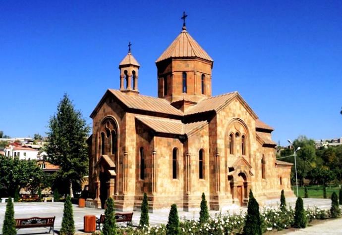
Armenia became a Christian nation in the early 4th century, during the reign of the Arsacid king Tiridates III. The 5th-century church of Saint Paul and Peter was among the earliest churches ever built in Erebuni (demolished in November 1930 by the anti-religious Soviet authorities).
Sasanian period

Katoghike Tsiranavor Church of Avan, 6th century
Following the partition of Armenia by the Byzantine Empire and Sassanid Persia in 387 and in 428, Erebuni and the entire territory of Eastern Armenian came under the rule of Sasanid Persia. The Armenian territories formed the province of Persian Armenia within theSasanian Empire.
Due to the diminished role of Erebuni, as well as the absence of proper historical data, much of the city’s history under the Sasanian rule is unknown.
The Katoghike Tsiranavor Church of Avan built between 595 and 602 during the Sasanian rule, is the city’s oldest surviving church (partly damaged during the 1679 earthquake).
The province of Persian Armenia (also known as Persarmenia) lasted until 646, when the province was dissolved with the Muslim conquest of Persia.
Arab Islamic invasion
In 658 AD, during the height of the Arab Islamic invasions, Erebuni-Yerevan was conquered during the Muslim conquest of Persia, as it was part of Persian-ruled Armenia. The city became part of the Emirate of Armenia under the Umayyad Caliphate. The city of Dvin was the centre of the newly created emirate. Starting from this period, as a result of the developing trade activities with the Arabs, the Armenian territories had gained an strategic importance as a crossroads for the Arab caravan routes passing between Europe and India through the Arab-controlled Ararat plain of Armenia. Most probably, “Erebuni” has become to be known as “Yerevan” since at least the 7th century AD.
Bagratid Armenia
After 2 centuries of Islamic rule over Armenia, the Bagratid prince Ashot I of Armenia led the revolution against the Abbasid Caliphate. Ashot I liberated Yerevan in 850, and was recognized as the Prince of Princes of Armenia by the Abbasid Caliph al-Musta’in in 862. Ashot was later crowned King of Armenia through the consent of Caliph al-Mu’tamid in 885. During the rule of the Bagratuni dynasty of Armenia between 885 and 1045, Yerevan was relatively a secure part of the Kingdom before being falling to the Byzantines.
However, Yerevan did not have any strategic role during the reign of the Bagratids, who developed many other cities of Ayrarat, such as Shirakavan, Dvin, and Ani.
Seljuk period, Zakarid Armenia and Mongol rule
After a brief Byzantine rule over Armenia between 1045 and 1064, the invading Seljuks led by Tughril ruled over the entire region, including Yerevan. However, with the establishment of the Zakarid Principality of Armenia in 1201 under the Georgian protectorate, the Armenian territories of Yerevan and Lori had significantly grown. After the Mongols captured Ani 1236, Armenia turned into a Mongol protectorate as part of the Ilkhanate, and the Zakarids became vassals to the Mongols. After the fall of the Ilkhanate in the mid-14th century, the Zakarid princes ruled over Lori, Shirak and Ararat plain until 1360 when they fell to the invading Turkic tribes.
Ag Qoyunlu and Kara Koyunlu tribes
During the last quarter of the 14th century the Ag Qoyunlu Sunni Oghuz Turkic tribe took over Armenia, including Yerevan. In 1400, Timur invaded Armenia and Georgia, and captured more than 60,000 of the survived local people as slaves. Many districts including Yerevan were depopulated.
In 1410, Armenia fell under the control of the Kara Koyunlu Shia Oghuz Turkic tribe. According to the Armeian historian Thomas of Metsoph, although the Kara Koyunlu levied heavy taxes against the Armenians, the early years of their rule were relatively peaceful and some reconstruction of towns took place. The Kara Koyunlus have made Yerevan the centre of the newly formed Chukhur Saad administrative territory. The territory was named after a Turkic leader known as Emir Saad.
However, this peaceful period was shattered with the rise of Qara Iskander between 1420 and 1436, who reportedly made Armenia a “desert” and subjected it to “devastation and plunder, to slaughter, and captivity”. The wars of Iskander and his eventual defeat against the Timurids, invited further destruction in Armenia, as many more Armenians were taken captive and sold into slavery and the land was subjected to outright pillaging, forcing many of them to leave the region.
Following the fall of the Armenian Kingdom of Cilicia in 1375, the seat of the Armenian Church was transferred from Sis back to Vagharshapat near Yerevan in 1441. Thus, Yerevan became the main economic, cultural and administrative centre in Armenia.
Iranian rule

An illustration of Yerevan by French traveler Jean Chardin in 1673 while he was travelling through the Safavid Empire

Yerevan in 1796 in the Qajar era, by G. Sergeevich. An Armenian church is seen on the left and a Persian mosque on the right
In 1501, Eastern Armenia including Yereven were swiftly conquered by the emerging Safavid dynasty of Iran led by Shah Ismail I.[29] Soon after in 1502, Yerevan became the centre of the Erivan Beglarbegi, a new administrative territory of Iran formed by the Safavids. For the following 3 centuries, it remained, with brief intermissions, under the Iranian rule. Due to its strategic significance, Yerevan was initially often fought over, and passed back and forth, between the dominion of the rivaling Iranian and Ottoman Empire, until it permanently became controlled by the Safavids. In 1555, Iran had secured its legitimate possession over Yerevan with the Ottomans through theTreaty of Amasya.
In 1582-1583, the Ottomans led by Serdar Ferhad Pasha took brief control over Yerevan. Ferhad Pasha managed to build the Erivan Fortress on the ruins of one thousand-years old ancient Armenian fortress, on the shores of Hrazdan river. However, the Ottomans ruled over the city until 1604 when the Persians regained control over Yerevan as a result of first Ottoman-Safavid War at the beginning of the 17th century.
Shah Abbas I of Persia who ruled between 1588 and 1629, ordered the deportation of hundreds of thousands of Armenians including citizens from Yerevan to mainland Persia. As a consequence, Yerevan significantly lost its Armenian population who had declined to 20%, while Muslims including Persians, Turks, Kurds and Tatars gained dominance with around 80% of the city’s population. Muslims were either sedentary, semi-sedentary, or nomadic. Armenians mainly occupied the Kond neighbourhood of Yerevan and the rural suburbs around the city. However, the Armenians dominated over various professions and trade in the area and were of great economic significance to the Persian administration.
As a result of the Treaty of Zuhab in 1639, the Iranians reconfirmed their control over Eastern Armenia, including Yerevan. On 7 June 1679, a devastating earthquake razed the city to the ground.
In 1724, the Erivan Fortress was besieged by the Ottoman army. After a period of resistance, the fortress fell to the Turks. As a result of the Ottoman invasion, the Erivan Beglarbegi of the Safavids was dissolved.
Following a brief period of Ottoman rule over Eastern Armenia between 1724 and 1736, and as a result of the fall of the Safavid dynasty in 1736, Yerevan along with the adjacent territories became part of the newly formed administrative territory of Erivan Khanate under the Afsharid dynasty of Iran, which encompassed an area encompassing 15,000 km². The Afsharids controlled Eastern Armenia from the mid 1730s until the 1790s. Following the fall of the Afsharids, the Qajar dynasty of Iran took control of Eastern Armenia until 1828, when the region was conquered by the Russian Empire after their victory over the Qajars that resulted in the Treaty of Turkmenchay of 1828. This was the 2nd major territorial loss for the Qajars, after the irrevocable loss of what is modern-day Georgia, Dagestan, and most of the contemporary Republic of Azerbaijan in favour of Russia as a result of the Treaty of Gulistan of 1813.
Russian rule
.jpg)
Franz Roubaud’s painting of theErivan Fortress siege in 1827 by the Russian forces under leadership of Ivan Paskevich during the Russo-Persian War (1826-1828)

Saint Gregory Church opened in 1900 (later destroyed in 1939)

The Main Square of Yerevan, 1916
During the second Russo-Persian War of the 19th century, the Russo-Persian War of 1826–28, Yerevan was captured by Russian troops under general Ivan Paskevich on 1 October 1827. It was formally ceded by the Iranians in 1828, following the Treaty of Turkmenchay. After 3 centuries of Iranian occupation, Yereven along with the rest of Eastern Armenia designated as the “Armenian Oblast”, became part of the Russian Empire, a period that would last until to collapse of the Empire in 1917. The Russians sponsored the resettlement process of the Armenian population from Persia and Turkey. Due to the resettlement, the percentage of the Armenian population of Yerevan increased from 28% to 53.8%. The resettlement was intended to create Russian power bridgehead in the Middle East. In 1829, Armenian repatriates from Persia were resettled in the city and a new quarter was built.
Yerevan served as the seat of the newly formed Armenian Oblast between 1828 and 1840. By the time of Nicholas I’s visit in 1837, Yerevan had become an uyezd. In 1840, the Armenian Oblast was dissolved and its territory incorporated into a new larger province; the Georgia-Imeretia Governorate. In 1850 the territory of the former oblast was reorganized into the Erivan Governorate, covering an area of 28,000 km². Yerevan was the centre of the newly established governorate. At the period, Yerevan was a small town with narrow roads and allies, including the central quarter of Shahar, the Ghantar commercial centre, and the residential neighbourhoods of Kond, Dzoragyugh, Nork and Shentagh. The first major plan of the city was adopted in 1856, during which, Saint Hripsime and Saint Gayane women’s colleges were founded and the English Park was opened. Zacharia Gevorkian opened Yerevan’s first printing house in 1874, and the first theatre 1879. The Astafyan street was redeveloped and opened in 1863. During the 1840s and the 1850s, many schools were opened in the city. In 1881, The Yerevan Teachers’ Seminary was opened. During the same year, the Yerevan Brewere was opened as well. In 1887, the Tairyan’s wine and brandy factory was inaugurated. Other factories for alcoholic beverages and mineral water were opened during the 1890s. The monumental church of Saint Gregory the Illuminator was opened in 1900. Electricity and telephone lines were introduced to the city in 1907 and 1913 respectively.
In general, Yerevan had rapidly grown under the Russian rule, both economically and politically. Old buildings torn down and new buildings of European style erected instead.
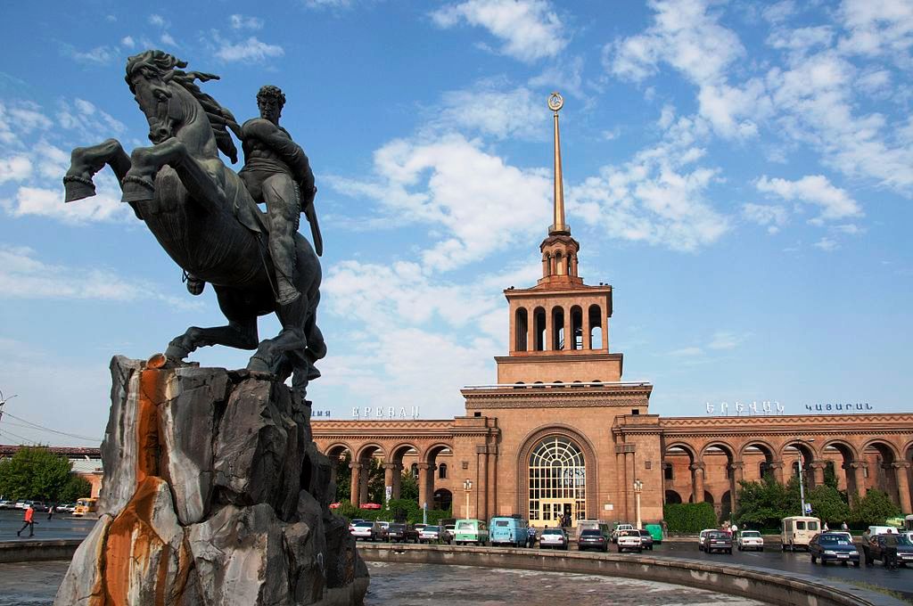
At the beginning of the 20th century, Yerevan city’s population was over 29,000. In 1902, a railway line linked Yerevan with Alexandropol, Tiflis and Julfa. In the same year, Yerevan’s first public library was opened. In 1905, the grandnephew of Napoleon I; prince Louis Joseph Jérôme Napoléon (1864–1932) was appointed as governor of Yerevan province. In 1913, for the first time in the city, a telephone line with eighty subscribers became operational.
Yerevan served as the centre of the governorate until 1917, when Erivan governorate was dissolved with the collapse of the Russian Empire.
Brief independence
,_Yerevan.jpg)
The government building of the First Republic of Armenia, from where Aram Manukian declared independence on May 28, 1918
At the beginning of the 20th century, Yerevan was a small city with a population of 30,000. In 1917, the Russian Empire ended with the October Revolution. In the aftermath, Armenian, Georgian and Muslim leaders of Transcaucasia united to form the Transcaucasian Federation and proclaimed Transcaucasia’s secession.
The Federation, however, was short-lived. After gaining control over Alexandropol (Gyumri), the Turkish army was advancing towards the south and east to eliminate the center of Armenian resistance based in Yerevan. On May 21, 1918, the Turks started their campaign moving towards Yerevan via Sardarabad. Catholicos Gevorg V ordered that church bells peal for 6 days as Armenians from all walks of life – peasants, poets, blacksmiths, and even the clergymen – rallied to form organized military units. Civilians, including children, aided in the effort as well, as “Carts drawn by oxen, water buffalo, and cows jammed the roads bringing food, provisions, ammunition, and volunteers from the vicinity” of Yerevan.
By the end of May 1918, Armenians were able to defeat the Turkish army in the battles of Sardarabad, Abaran and Karakilisa. Thus, on 28 May 1918, the Dashnak leader Aram Manukian declared the independence of Armenia. Subsequently, Yerevan became the capital and the center of the newly founded Republic of Armenia, although the members of the Armenian National Council were yet to stay in Tiflis until their arrival in Yerevan to form the government in the summer of the same year. Armenia became a parliamentary republic with four administrative divisions. The capital Yerevan was part of the Araratian Province. At the time, Yerevan received more than 75,000 refugees from Western Armenia, who escaped the massacres perpetrated by the Ottoman Turks during the Armenian Genocide.
On 26 May 1919, the government passed a law to open the Yerevan State University, which was located on the main Astafyan (now Abovyan) street of Yerevan.
After the signing of the Treaty of Sèvres in 1920, Armenia was granted formal international recognition. The United States, as well as many South American countries, officially opened diplomatic channels with the government of independent Armenia. Yerevan had also opened representatives in Great Britain, Italy, Germany, Serbia, Greece, Iran andJapan.
However, after the short period of independence, Yerevan fell to the Bolsheviks, and Armenia was incorporated into the Soviet Union on 2 December 1920. Although nationalist forces managed to retake the city in February 1921 and successfully released all the imprisoned political and military figures, the city’s nationalist elite were once again defeated by the Soviet forces on 2 April 1921.
Soviet era

Mother Armenia erected in 1967, replacing the monumental statue ofJoseph Stalin
.jpg)
Monument commemorating the 50th anniversary of the Sovietization of Armenia
The Red Soviet Army invaded Armenia on 29 November 1920 from the northeast. On 2 December 1920, Yerevan along with the other territories of the Republic of Armenia, became part of the Soviet Union, known as the Armenian Soviet Socialist Republic. However, the Armenian SSR formed the Transcaucasian SFSR (TSFSR) together with the Georgian Soviet Socialist Republic and the Azerbaijan Soviet Socialist Republic, between 1922 and 1936.
Under the Soviet rule, Yerevan became the first among the cities in the Soviet Union for which a general plan was developed. The “General Plan of Yerevan” developed by the academician Alexander Tamanian, was approved in 1924. It was initially designed for a population of 150,000. The city was quickly transformed into a modern industrial metropolis of over one million people. New educational, scientific and cultural institutions were founded as well.
Tamanian incorporated national traditions with contemporary urban construction. His design presented a radial-circular arrangement that overlaid the existing city and incorporated much of its existing street plan. As a result, many historic buildings were demolished, including churches, mosques, the Persian fortress, baths, bazaars and caravanserais. Many of the districts around central Yerevan were named after former Armenian communities that were destroyed by the Ottoman Turks during the Armenian Genocide. The districts of Arabkir, Malatia-Sebastia and Nork Marash, for example, were named after the towns Arabkir, Malatya, Sebastia, and Marash, respectively. After the end of World War II, German POWs were used to help in the construction of new buildings and structures, such as the Kievyan Bridge.
Within the years, the central Kentron district has become the most developed area in Yerevan, something that created a significant gap compared with other districts in the city. Most of the educational, cultural and scientific institutions were centred in the Kentron district.
In 1965, during the commemorations of the fiftieth anniversary of the Armenian Genocide, Yerevan was the location of a demonstration, the first such demonstration in the Soviet Union, to demand recognition of the Genocide by the Soviet authorities. In 1968, the city’s 2,750th anniversary was commemorated.
Yerevan played a key role in the Armenian national democratic movement that emerged during the Gorbachev era of the 1980s. The reforms of Glasnost and Perestroikaopened questions on issues such as the status of Nagorno-Karabakh, the environment, Russification, corruption, democracy, and eventually independence. At the beginning of 1988, nearly one million Yerevantsis engaged in demonstrations concerning these subjects, centered on the Theater Square (currently Freedom Square).
Independence era

The Northern Avenue

Nighttime view of Yerevan, September 2013
Following the dismantling of the USSR, Yerevan became the capital of the Republic of Armenia on 21 September 1991. Maintaining supplies of gas and electricity proved difficult; constant electricity was not restored until 1996 amidst the chaos of the badly instigated and planned transition to a market based economy.
Since 2000, central Yerevan has been transformed into a vast construction site, with cranes erected all over the Kentron district. Officially, the scores of multi-storied buildings are part of large-scale urban planning projects. Roughly $1.8 billion was spent on such construction in 2006, according to the national statistical service. Prices for downtown apartments have increased by about ten times during the first decade of the 21st century. Many new streets and avenues were opened, such as the Argishti street, Italy street, Saralanj Avenue, Monte Melkonian Avenue, and the Northern Avenue.
However, as a result of this construction booming, the majority of the historic buildings located on the central Aram Street, were either entirely destroyed or transformed into modern residential buildings through the construction of additional floors. Only few structures were preserved, mainly in the portion that extends from Abovyan Street to Mashtots Avenue.
Political demonstrations turned into a common scene in Yerevan. In 2008, unrest in the capital between the authorities and opposition demonstrators led by ex-President Levon Ter-Petrosyan occurred after the 2008 Armenian presidential election. The events resulted in ten deaths and a subsequent 20-day state of emergency declared by PresidentRobert Kocharyan.
Geography

Yerevan is situated at the northeast of Ararat plain

Yerevan on the shores of Hrazdan River
Topography and location
Yerevan has an average height of 990 m (3,248.03 ft), with a minimum of 865 m (2,837.93 ft) and a maximum of 1,390 m (4,560.37 ft) above sea level. It is located on to the edge of the Hrazdan River, northeast of the Ararat plain (Ararat Valley), to the center-west of the country. The upper part of the city is surrounded with mountains on three sides while it descends to the banks of the river Hrazdan at the south. The Hrazdan divides Yerevan into two parts through a picturesque canyon.
Historically, the city is situated at the heart of the Armenian Highland, in Kotayk canton (Armenian: Կոտայք գավառ Kotayk gavar, not to be confused with the current Kotayk Province) of Ayrarat province, within Armenia Major.
As the capital of Armenia, Yerevan is not part of any marz (“province”). Instead, it is bordered with the following provinces: Kotayk from the north and the east, Ararat from the south and the south-west, Armavir from the west and Aragatsotn from the north-west.
Climate
Yerevan features a steppe climate (Köppen climate classification: BSk), with long, hot, dry summers and short, but cold and snowy winters. This is attributed to Yerevan being on a plain surrounded by mountains and to its distance from the sea and its effects. The summers are usually very hot with the temperature in August reaching up to 40 °C (104 °F), and winters generally carry snowfall and freezing temperatures with January often being as cold as −15 °C (5 °F) and lower. The amount of precipitation is small, amounting annually to about 318 millimetres (12.5 in). Yerevan experiences an average of 2,700 sunlight hours per year. Temperature regime in Yerevan is close to the southern Midwest cities such as Kansas City, Missouri, and Omaha, Nebraska, though Yerevan is much drier.
Capital
Yerevan has been the capital of Armenia since the independence of the First Republic in 1918. Situated in the Ararat plain, the historic lands of Armenia, it served as the best logical choice for capital of the young republic at the time.
When Armenia became a republic of the Soviet Union, Yerevan remained as capital and accommodated all the political and diplomatic institutions in the republic. In 1991 with the independence of Armenia, Yerevan continued with its status as the political and cultural centre of the country, being home to all the national institutions: the Government house, the Parliament, ministries, the presidential palace, the constitutional court, judicial bodies and other public organisations.
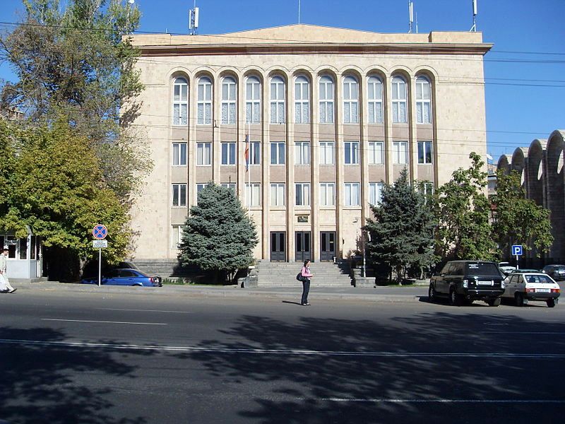
Municipality

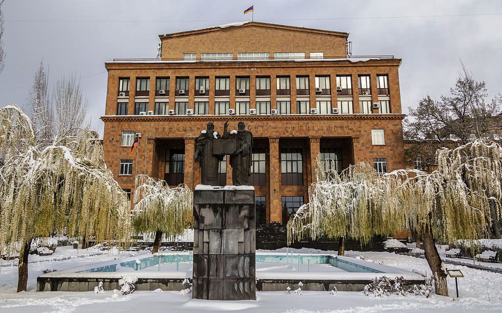
Yerevan City Hall
The Armenian Constitution, adopted on 5 July 1995, granted Yerevan the status of a marz (region). Therefore, Yerevan functions similarly to the other regions of the country with a few specificities. The administrative authority of Yerevan is thus represented by:
- the mayor, appointed by the President (who can remove him at any moment) upon the recommendation of the Prime Minister, alongside a group of four deputy mayors heading eleven ministries (of which financial, transport, urban development etc.),
- the Yerevan City Council, regrouping the Heads of community districts under the authority of the mayor,
- twelve “community districts”, with each having its own leader and their elected councils. Yerevan has a principal city hall and twelve deputy mayors of districts.
The last modification to the Constitution on 27 November 2005 turned the city into a “community” (hamaynk); since, the Constitution declares that this community has to be led by a mayor, elected directly or indirectly, and that the city needs to be governed by a specific law. This law is currently in preparation in the Armenian parliament that adopted its first draft in December 2007 and should do the same in the second draft in spring of 2008. The project on the law envisions an indirect election of the mayor.
In addition to the national police and road police, Yerevan has its own municipal police. All three bodies cooperate to maintain law in the city.
Districts

The twelve districts of Yerevan
Yerevan is divided into twelve “administrative districts” (վարչական շրջան, varčakan šrĵan) each with an elected leader. The total area of the 12 districts of Yerevan is 223 square kilometres (86 square miles).
| District | Armenian | Population (2011 census) | Area (km²) |
|---|---|---|---|
| Ajapnyak | Աջափնյակ | 108,282 | 25 |
| Arabkir | Արաբկիր | 117,704 | 12 |
| Avan | Ավան | 53,231 | 8 |
| Davtashen | Դավթաշեն | 42,380 | 6 |
| Erebuni | Էրեբունի | 123,092 | 48 |
| Kanaker-Zeytun | Քանաքեր-Զեյթուն | 73,886 | 8 |
| Kentron | Կենտրոն | 125,453 | 14 |
| Malatia-Sebastia | Մալաթիա-Սեբաստիա | 132,900 | 26 |
| Nork-Marash | Նորք-Մարաշ | 12,049 | 4 |
| Nor Nork | Նոր Նորք | 126,065 | 14 |
| Nubarashen | Նուբարաշեն | 9,561 | 18 |
| Shengavit | Շենգավիթ | 135,535 | 40 |
Demographics
After the collapse of the Soviet Union, due to economic crises, thousands fled Armenia, mostly to Russia, North America and Europe. The population of Yerevan fell from 1,250,000 in 1989 to 1,103,488 in 2001 and to 1,091,235 in 2003. However, the population of Yerevan has been increasing since. In 2007, the capital had 1,107,800 inhabitants.Originally a small town, Yerevan became the capital of Armenia and a large city with over one million inhabitants. Until the fall of the Soviet Union, the majority of the population of Yerevan were Armenians with minorities of Russians, Kurds, Azerbaijanisand Iranians present as well. However, with the breakout of the Nagorno-Karabakh War from 1988 to 1994, the Azerbaijani minority diminished in the country in what was part of population exchanges between Armenia and Azerbaijan. A big part of the Russian minority also fled the country during the 1990s economic crisis in the country. Today, the population of Yerevan is overwhelmingly Armenian.
Ethnic groups

Saint Nikolai Russian Cathedral, destroyed in 1931
Yerevan was inhabited first by Armenians and remained homogeneous until the 15th century.[61][62][74] The population of the Erivan Fortress, founded in the 1580s, was mainly composed of Muslim soldiers, estimated two to three thousand. The city itself was mainly populated by Armenians. French traveler Jean-Baptiste Tavernier, who visited Yerevan possibly up to six times between 1631 and 1668, states that the city is exclusively populated by Armenians. During the 1720’s Ottoman–Persian War its absolute majority were Armenians. The demographics of the region changed because of a series of wars between the Ottoman Empire, Iran and Russia. By the early 19th century, Yerevan had a Muslim majority.
Until the Sovietizaton of Armenia, Yerevan was a multicultural city, mainly with Armenian and Caucasian Tatar (nowadays Azerbaijanis) population. After the Armenian Genocide, many refugees from what Armenians call Western Armenia (nowadays Turkey, then Ottoman Empire) escaped to Eastern Armenia. In 1919, about 75,000 Armenian refugees from the Ottoman Empire arrived in Yerevan, mostly from the Vaspurakan region (city of Van and surroundings). A significant part of these refugees died of typhus and other diseases.
From 1921 to 1936, about 42,000 ethnic Armenians from Iraq, Turkey, Iran, Greece, Syria, France, Bulgaria etc. came to Soviet Armenia, with most of them settling in Yerevan. The second wave of repatriation occurred from 1946 to 1948, when about 100,000 ethnic Armenians from Iran, Syria, Lebanon, Greece, Bulgaria, Romania, Cyprus, Palestine, Iraq, Egypt, France, United States etc. came to Soviet Armenia, again most of whom settled in Yerevan. Thus, the ethnic makeup of Yerevan became more monoethnic during the first 3 decades in the Soviet Union. In the late 1980s and the early 1990s, the remaining 2,000 Azeris left the city, because of theNagorno-Karabakh conflict.
Religion

Saint John the Baptist Church of 1710

Catholicos Karekin II andarchbishop Rowan Williams at theArmenian Genocide memorial in Yerevan
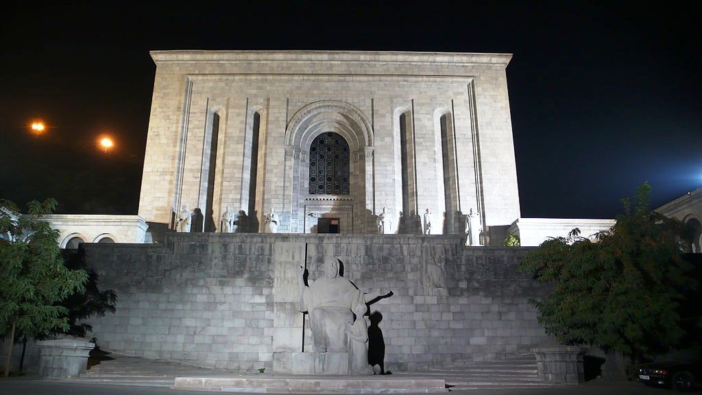
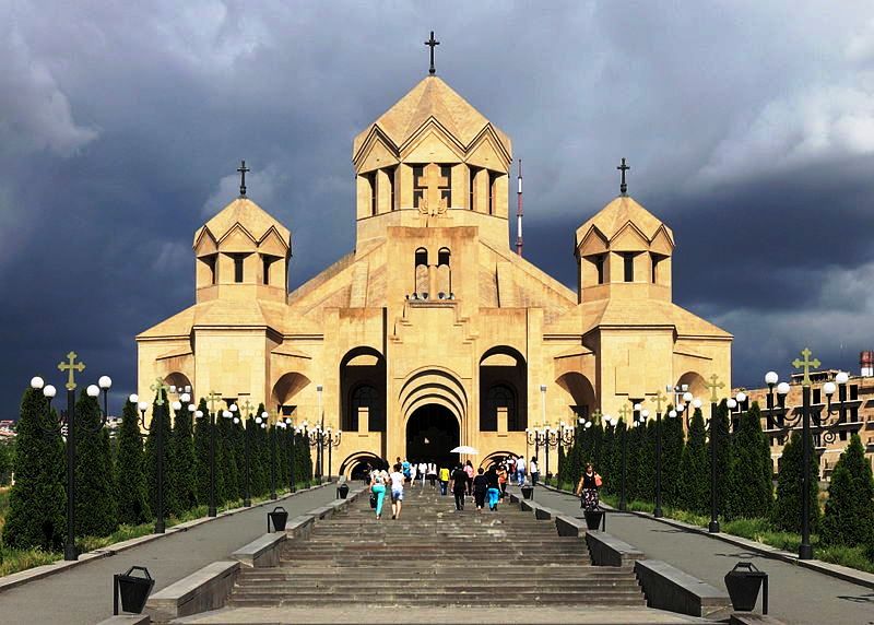
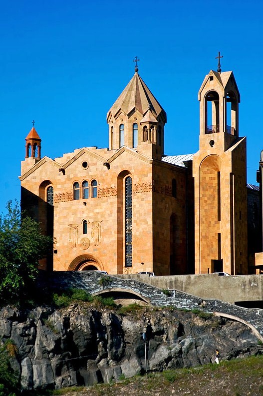
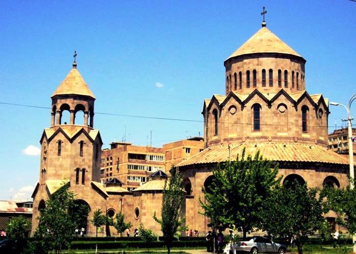
The Armenian Apostolic Christianity is the dominant religion in Armenia as well as Yerevan. The Armenian Church is represented in the city by the Araratian Patriarchal Diocese, with the Surp Sarkis Cathedral being the seat of the prelacy. Yerevan is home to the largest Armenian church in the world, the Cathedral of Saint Gregory the Illuminator, opened in 2001 when the entire Armenian nation had celebrated the 1700th anniversary of the establishment of the Armenian Church and the adoption of Christianity as a state religion in Armenia.
The tiny community of the Orthodox Russians has its own Church of the Intercession of the Holy Mother of God, located in the Kanaker-Zeytun district of Yerevan. The church was built across the barracks of the Cossack troops which had been deployed in Yerevan since the Russian victory in the Russian-Persian war in 1828. The church was closed in the Soviet times to be used first as a warehouse and later as a regimental club. Divine services were resumed in it only in 1991. In 2004, the reconstructed church re-acquired a cupola and a belfry. The consecration of the new Holy Cross Russian Orthodox church of Yerevan was conducted on 18 March 2010, by Patriarch Kirill I of Moscow. The church is being built on Admiral Isakov Avenue and is set to be completed by the end of 2013.
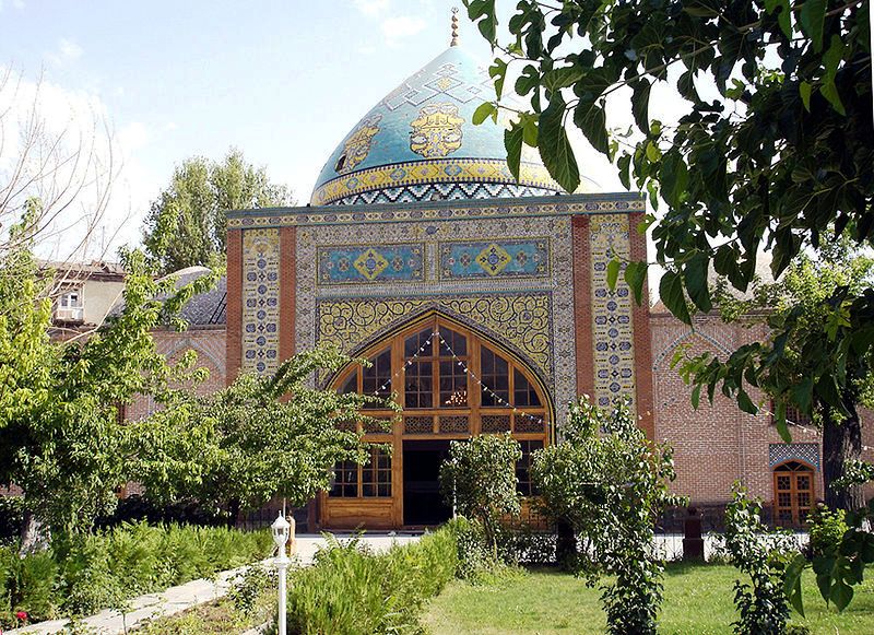
After the capture of Yerevan by Russians as result of the Russo-Persian War, the main mosque in the fortress, built by the invading Turks in 1582, was converted into an Orthodox church under the orders of the Russian commander, general Ivan Paskevich. The church was sanctified on 6 December 1827 and named the Church of the Intercession of the Holy Mother of God. According to Ivan Chopin, there were eight mosques in Yerevan in the middle of the 19th century. The 18th-century Blue Mosque of Yerevan was restored and reopened in the latter half of the 1990s funded by Iran, to become the only active mosque throughout the Republic of Armenia. Nowadays, Islamic religious services are conducted within the Blue Mosque to serve the Shia Iranian visitors and tradesmen.
Few members of the Yezidi and Jewish communities of Armenia live in Yerevan. The city is home to the Jewish Council of Armenia. A variety of other minor religious communities are also present in the city.
Tourism and nightlife

Dalma Garden Mall

Yerevan Hotel built in 1926, nowadays part of the Groupe du Louvre’s Royal Tulip brand

Yerevan Water World
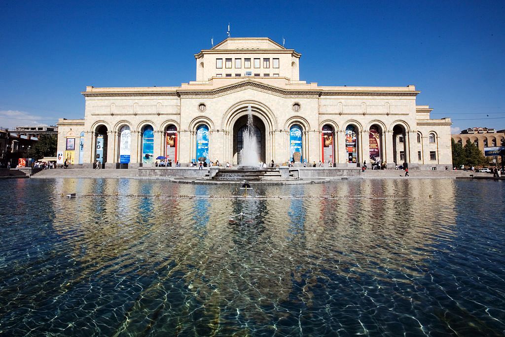
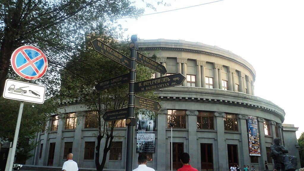
Tourism in Armenia is developing year by year and the capital city of Yerevan is one of the major tourist destinations. The city has a majority of luxury hotels, modern restaurants, bars, pubs and nightclubs. Zvartnots airport has also conducted renovation projects with the growing number of tourists visiting the country. Numerous places in Yerevan are attractive for tourists, such as the dancing fountains of the Republic Square, the State Opera House, the Cascade complex, the ruins of theUrartian city of Erebuni (Arin Berd), the historical site of Karmir Blur (Teishebaini), etc. The largest hotel of the city is the Multi Grand Hotel located to the north of Yerevan. The Armenia Marriott Hotel is situated in the heart of the city at Republic Square, while the Radisson Blu Hotel Yerevan is located near theVictory Park. Other major chains present in central Yerevan include the Royal Tulip Yerevan Hotel, the Best Western Congress Hotel, theDoubleTree by Hilton and the Hyatt Place.
The location of Yerevan itself, is an inspiring factor for the foreigners to visit the city in order to enjoy the view of the biblical mount of Ararat, as the city lies on the feet of the mountain forming the shape of a Roman amphitheatre.
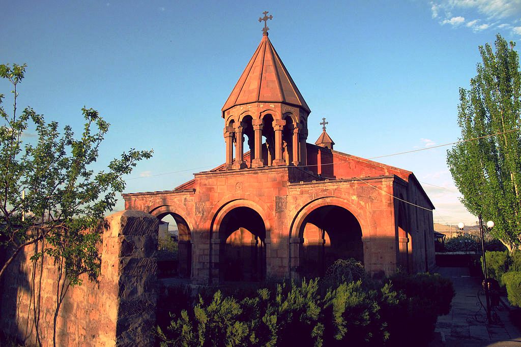
There are many historical sites, churches and citadels in areas and regions surrounding the city of Yerevan, such as the Garni Temple,Zvartnots Cathedral, Khor Virap, etc.
Being among the top 10 safest countries in the world, Yerevan has an extensive nightlife scene with a variety of nightclubs,[105] live venues, pedestrian zones, street cafes, jazz cafes, tea houses, casinos, pubs, karaoke clubs and restaurants. Casino Shangri La and Pharaon Complex are the largest leisure and entertainment centres of the city. Yerevan frequently hosts several world-famous music stars.
- Yerevan Zoo: founded in 1940 and operated by the Yerevan municipality, is home to 1500 different animals and 260 species.
- Yerevan Circus: opened in 1956 in the centre of Yerevan. The famous Soviet clown Leonid Yengibarian was one of the prominent actors of the Yerevan circus between 1959 and 1971.
- Northern Avenue: is a pedestrian street with modern residences, business centres, restaurants and cafés. It connects the Opera House with Abovyan street.
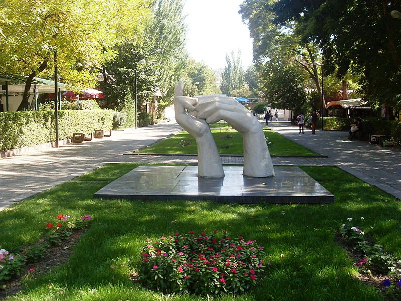
- Cafesjian Center for the Arts at the Yerevan Cascade, and the “Cafesjian Sculpture Garden” at the Tamanyan Street: the street is a pedestrian zone, with several types of coffee shops, bars, restaurants, and pubs found at the sidewalks.
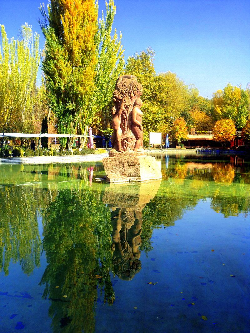
- Public parks: districts throughout the city are graced with large green parks with the most popular being the Lovers’ Park on Marshal Baghramyan Avenue. The Yerevan Botanical Garden opened in 1935 is one of the largest parks in the city along with the Victory park and the Circular Park. Other parks in Yerevan include: the English Park of the 1860s, the Buenos Aires Park and Tumanyan Park in Ajapnyak, Komitas park in Shengavit, Vahan Zatikian park in Malatia-Sebastia, David Anhaght park in Kanaker-Zeytun, the Family park in Avan, Fridtjof Nansen park in Nor Nork and the Lyon Park in Erebuni.
- Yerevan Water World and Play City amusement park are also among the favourite entertaining centres.
- Dalma Garden Mall, opened in October 2012 near the Tsitsernakaberd hill.
- Yerevan Mall, opened in February 2014 on Arshakunyats Avenue and is home to the first Carrefour hypermarket in Armenia.